The Hanging Cliff Mine: A Forgotten Corner of the Skidoo District

Death Valley National Park, Panamint Range
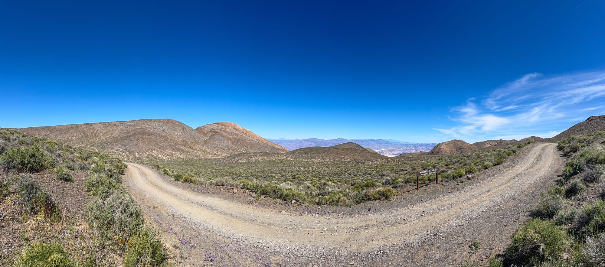
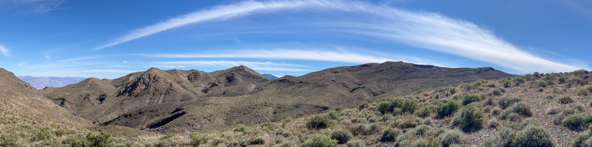
The wilderness boundary sign marks the old road to the Hanging Cliff Mine (and further east, the Garibaldi Mine). Once you pass it, the eastern Skidoo district opens up around you, a broad plateau ringed by canyon edges, the salt flats of Death Valley visible through every gap in the ridgeline five thousand feet below. Most people who make it this far stay on the main track heading west toward the famous fifteen-stamp mill. The Hanging Cliff Mine requires a turn before you ever reach the townsite, heading east instead toward the canyon rim.
The Skidoo District Background (1906-1917)
The Skidoo Mining District came to life in January 1906 when two prospectors named John Ramsey and John "One-Eye" Thompson got turned around in a rare desert fog near Emigrant Spring. They were headed to the gold strike at Harrisburg and camped to wait out the weather. When the fog lifted they noticed the ledge colors on the surrounding hillsides and staked their own claims instead of continuing on. Bob Montgomery eventually purchased their Gold Eagle group and assembled the dominant Skidoo Mine property, building an eighteen-mile gravity pipeline from Birch Spring near Telescope Peak to power his stamp mill at a cost of $250,000.
Surrounding Montgomery's operation were scores of independent claims filed by smaller syndicates hoping to tap the same gold-bearing vein systems. The geology was favorable across the entire area. The district is hosted in the Skidoo Pluton, a quartz monzonite intrusion crosscut by gold-bearing quartz veins averaging eighteen inches to two feet thick, striking northwest and east-west. The same vein system that fed the Skidoo Mine's main workings threaded through the surrounding hillsides in multiple parallel threads, and those threads drew prospectors into every canyon and bench for miles around.
By 1907 the rush had filled not just the Skidoo townsite but the entire plateau. At its peak the district produced about 75,000 ounces of gold worth more than $1.5 million. The surrounding hills now hold an estimated thousand mine entrances and workings, the great majority anonymous prospect holes that never amounted to much. The Hanging Cliff Mine is one of the ones that did.

The Mine and Its Name
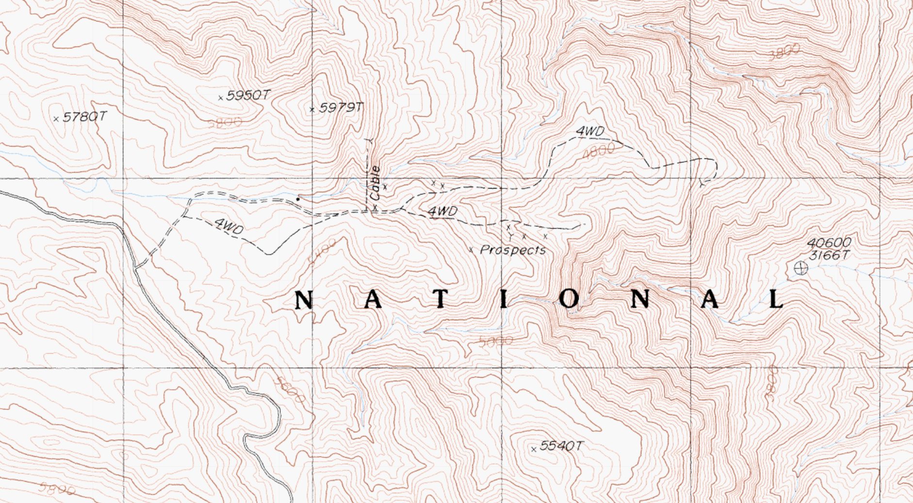
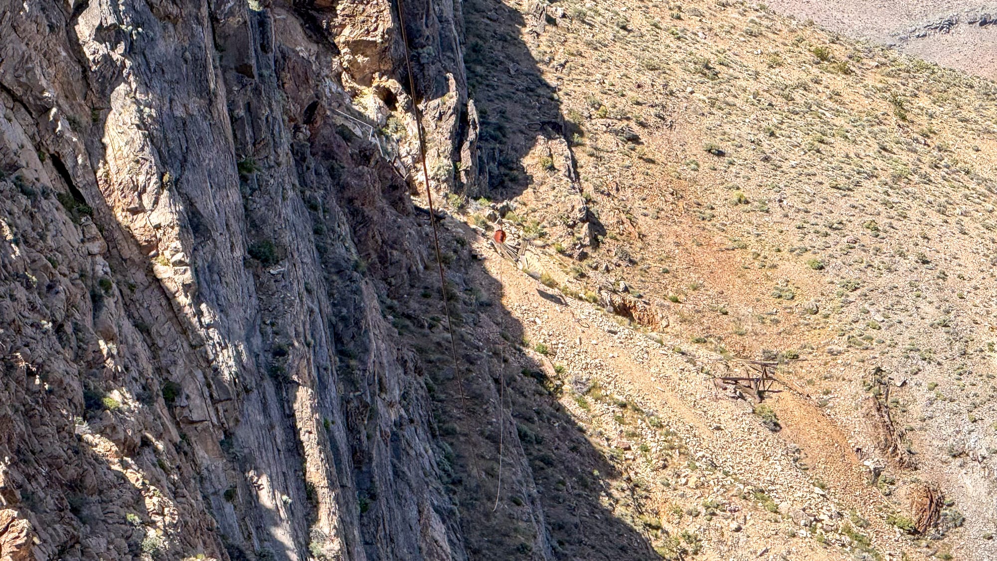
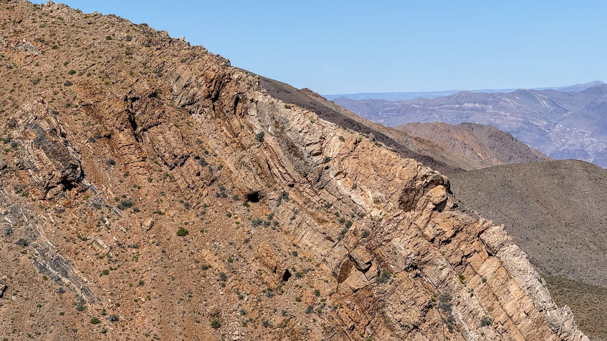
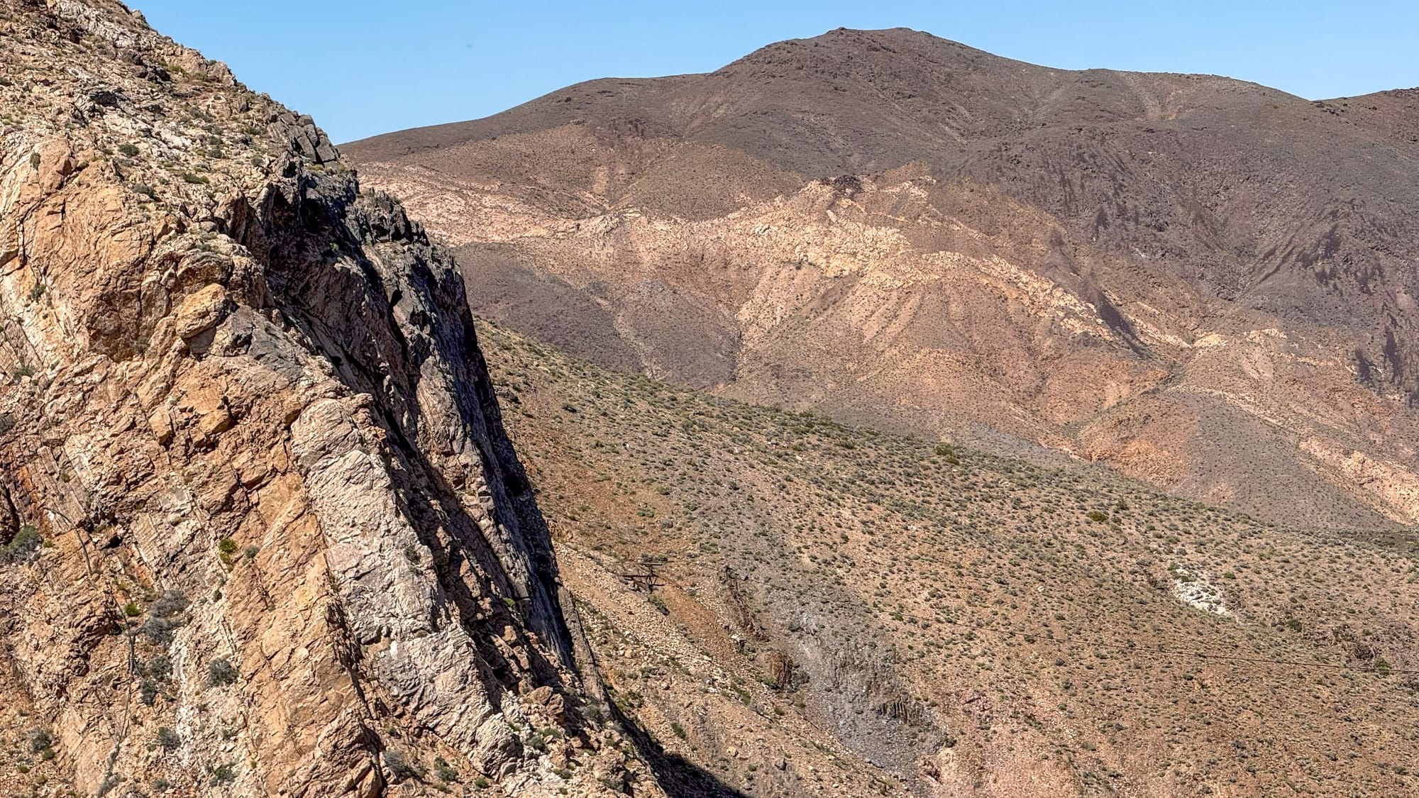
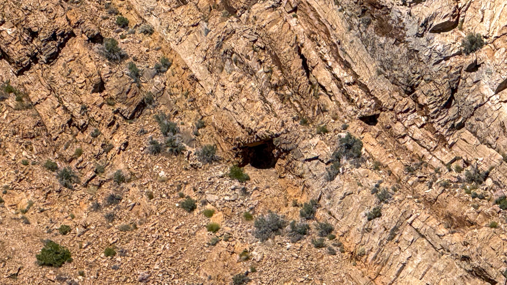
The name is not metaphorical. The Hanging Cliff Mine is on a cliff. Specifically, it occupies the face of a vertical-walled canyon on the eastern edge of the Skidoo plateau, where the Panamint Range breaks sharply toward Death Valley. Standing at the cableway terminus on the mill side and looking across, you can see the adits punched directly into dark, steeply dipping metasedimentary rock. There is no trail to them. There was never a road. The only way ore ever left that cliff face was by cable.
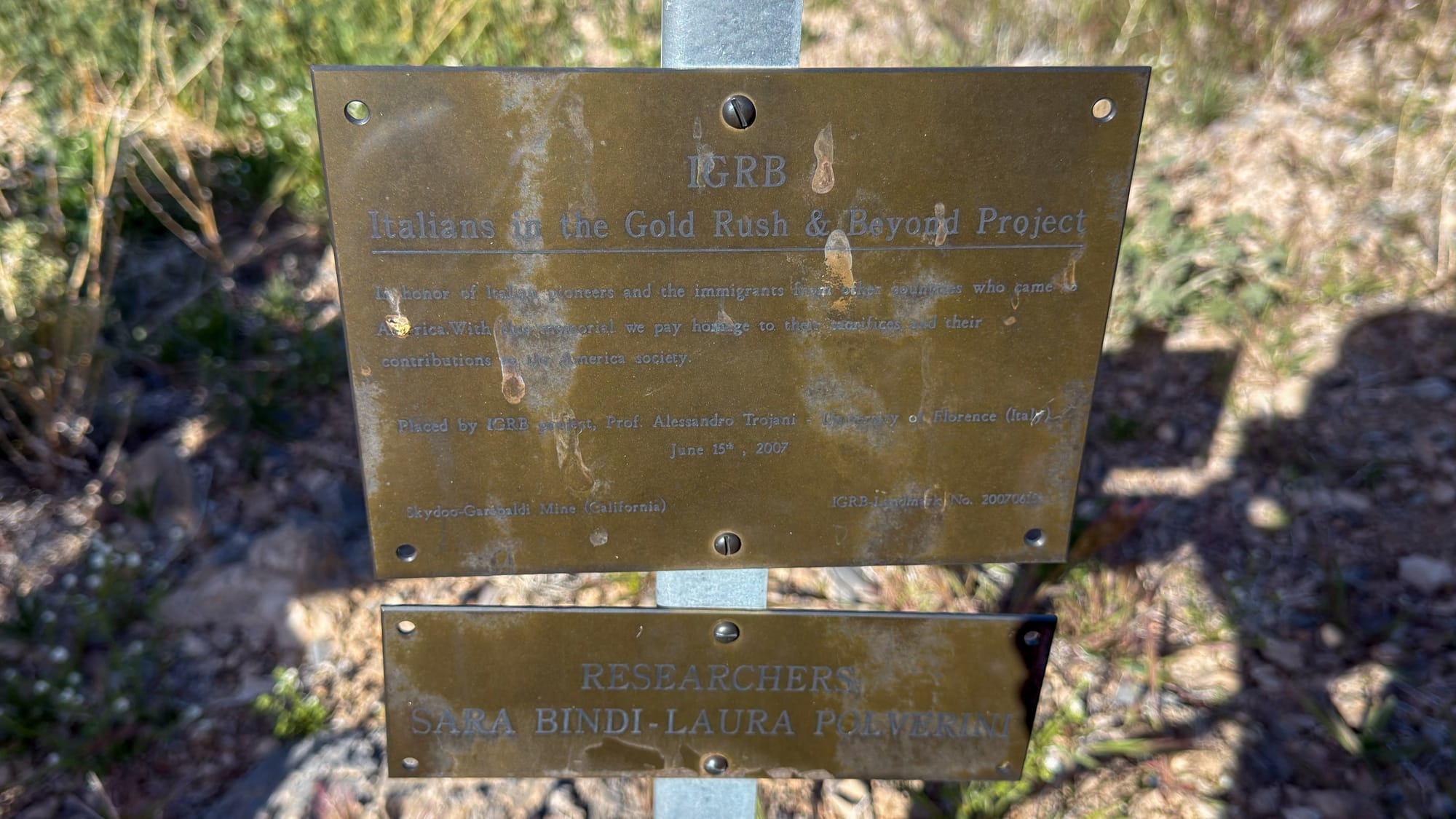
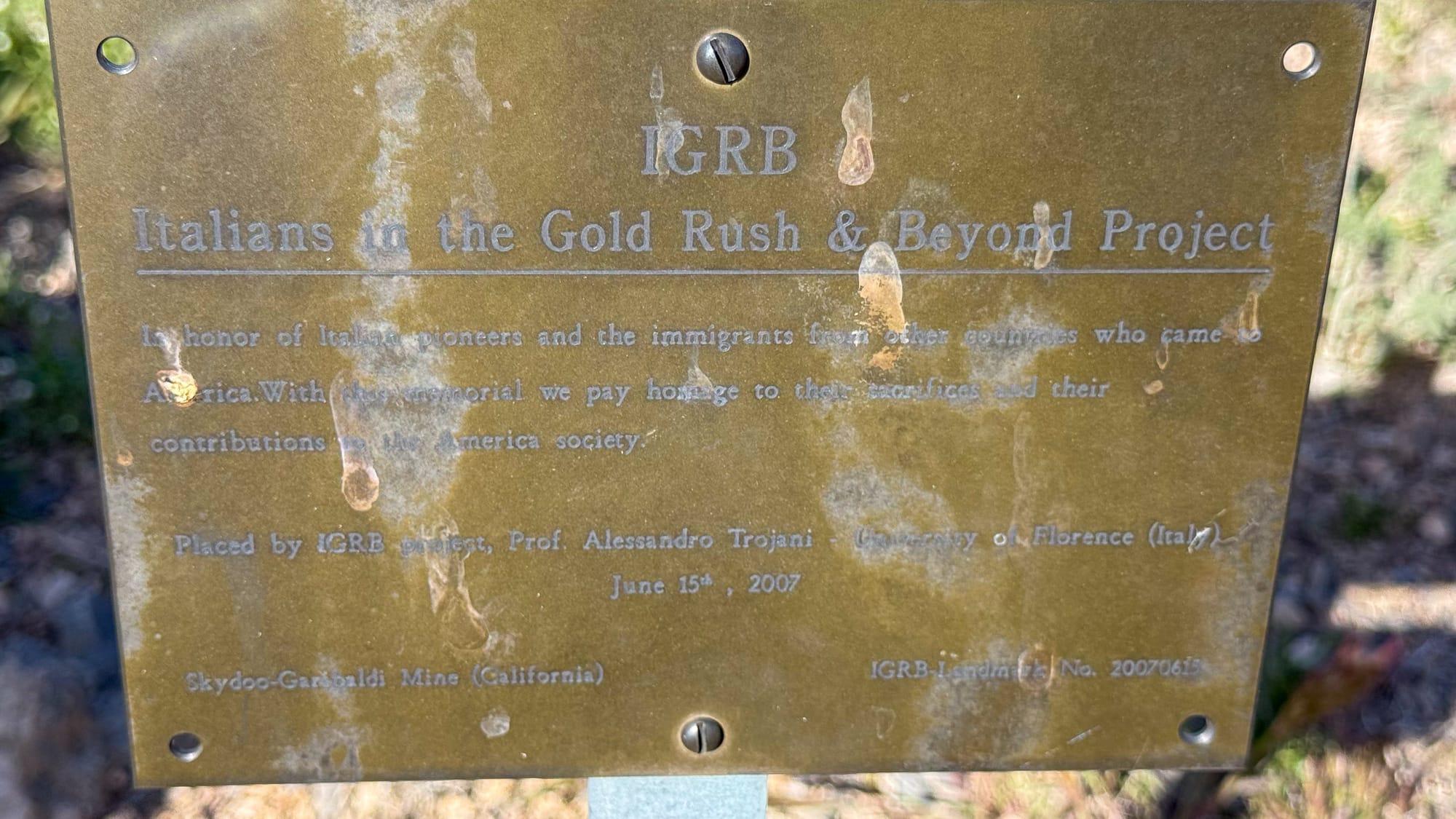
This is also a property with a documented Italian connection. A bronze plaque placed at the site in June 2007 by Prof. Alessandro Trojani of the University of Florence, on behalf of the Italians in the Gold Rush and Beyond Project, designates this as the Skydoo-Garibaldi Mine and honors the Italian pioneers who worked it. The Garibaldi name goes back to around 1874-75, when a party of Italian immigrants, Joe and Zeff Nossano, Joe Lanji, and Charles Andrietta, discovered a group of silver mines in the Wild Rose Spring District in the vicinity of present-day Harrisburg. That property changed hands and names repeatedly over the following decades, eventually becoming the Blue Bell Mine and later the Garibaldi Mine, before the Skidoo boom drew renewed attention to the whole area. The Hanging Cliff workings are part of that same cluster, sitting on the canyon rim just east of the main Skidoo plateau.
The Cableway
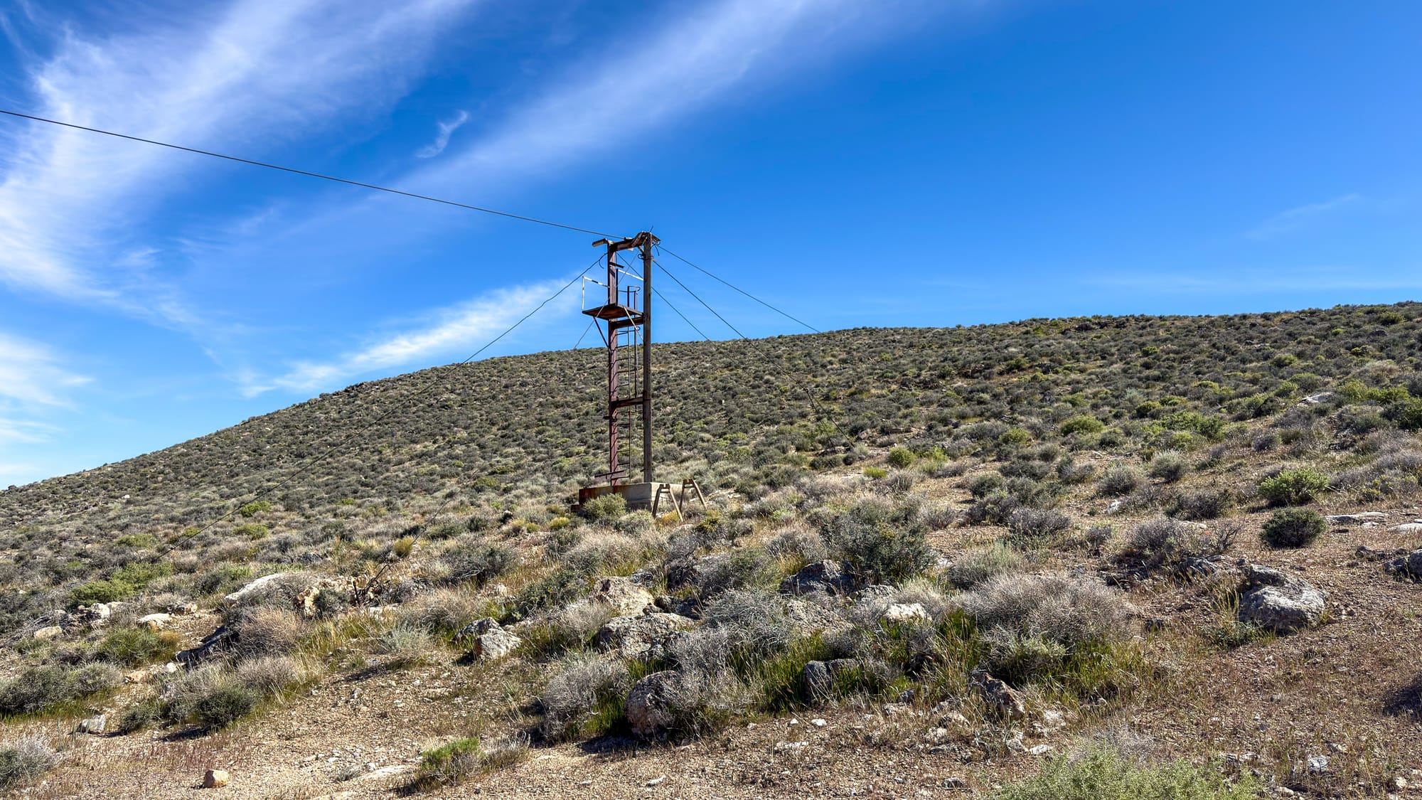
The cableway is the reason I came here, and it is in remarkable condition for infrastructure that was put up in the 1950s.
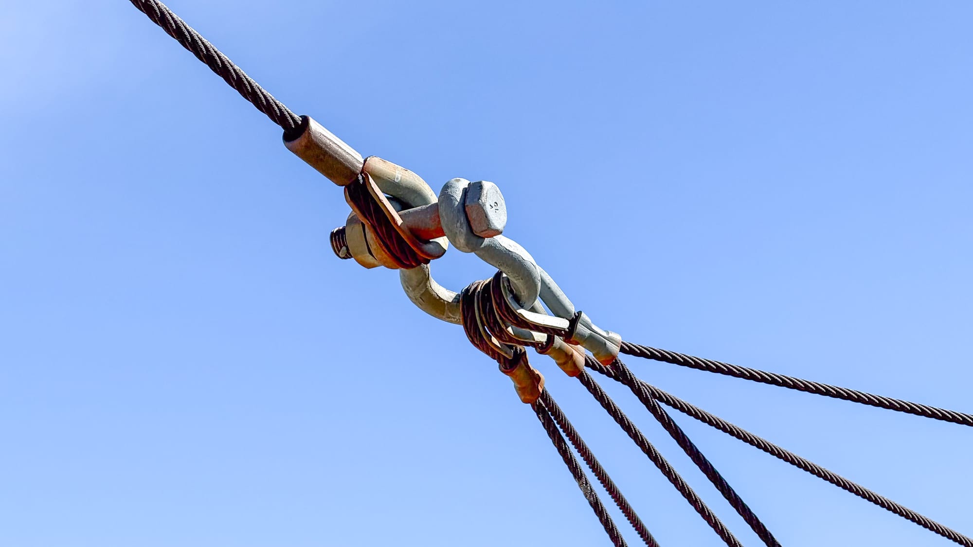
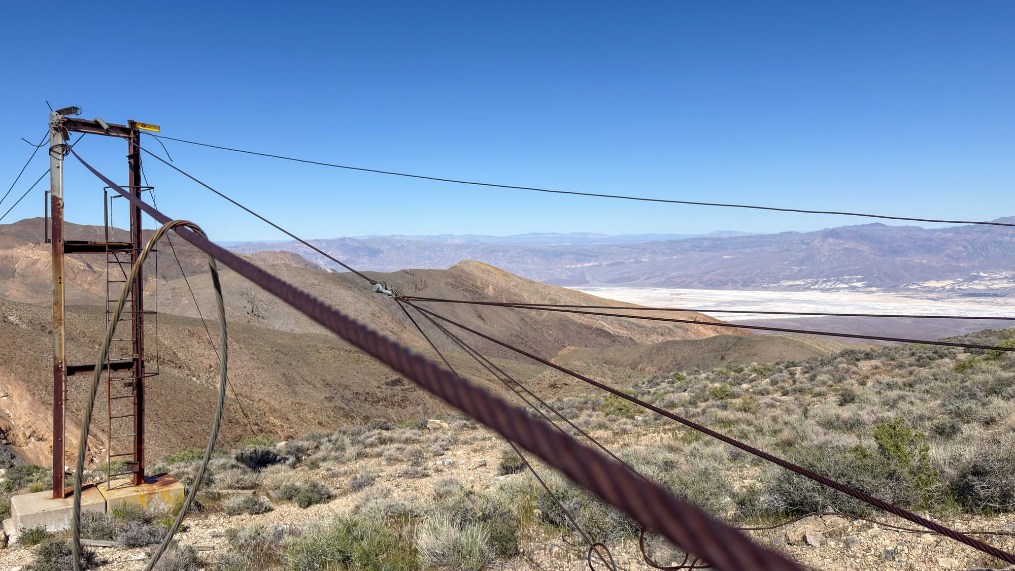
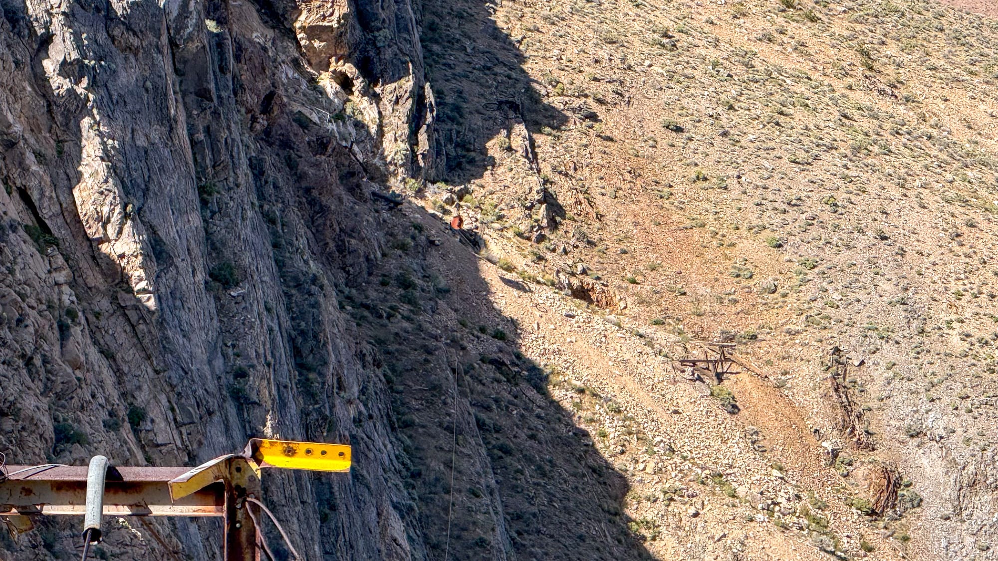
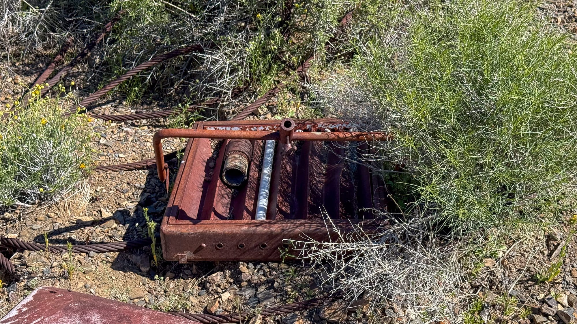
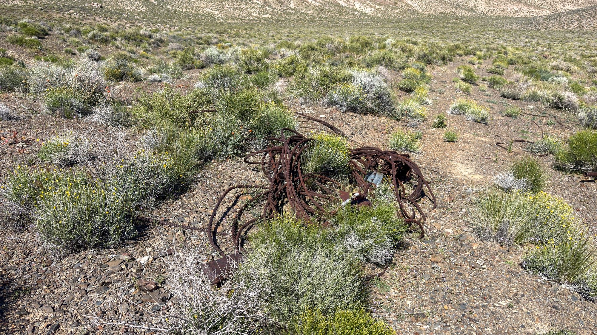
The millsite-end tower is a steel H-frame bolted to a concrete footing on the plateau rim, still fully upright. The main haul cable runs from it across the canyon toward the cliff face opposite, and a fan of guy wires holds the tower in tension against the load. The rigging hardware, shackles, cable clamps and turnbuckles, looks tight. The wire rope itself, in multiple runs, fans out from the tower head and lies coiled and anchored to bedrock outcrops nearby, the loops secured with bolted cable clamps through the rock.
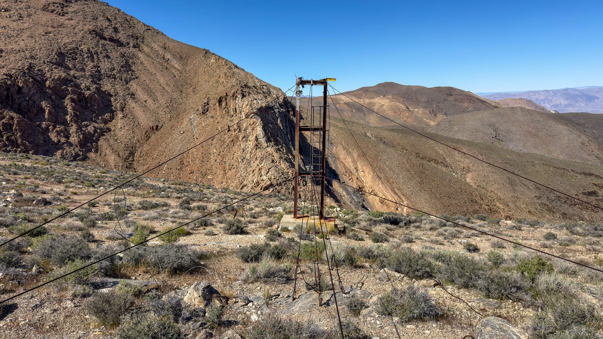
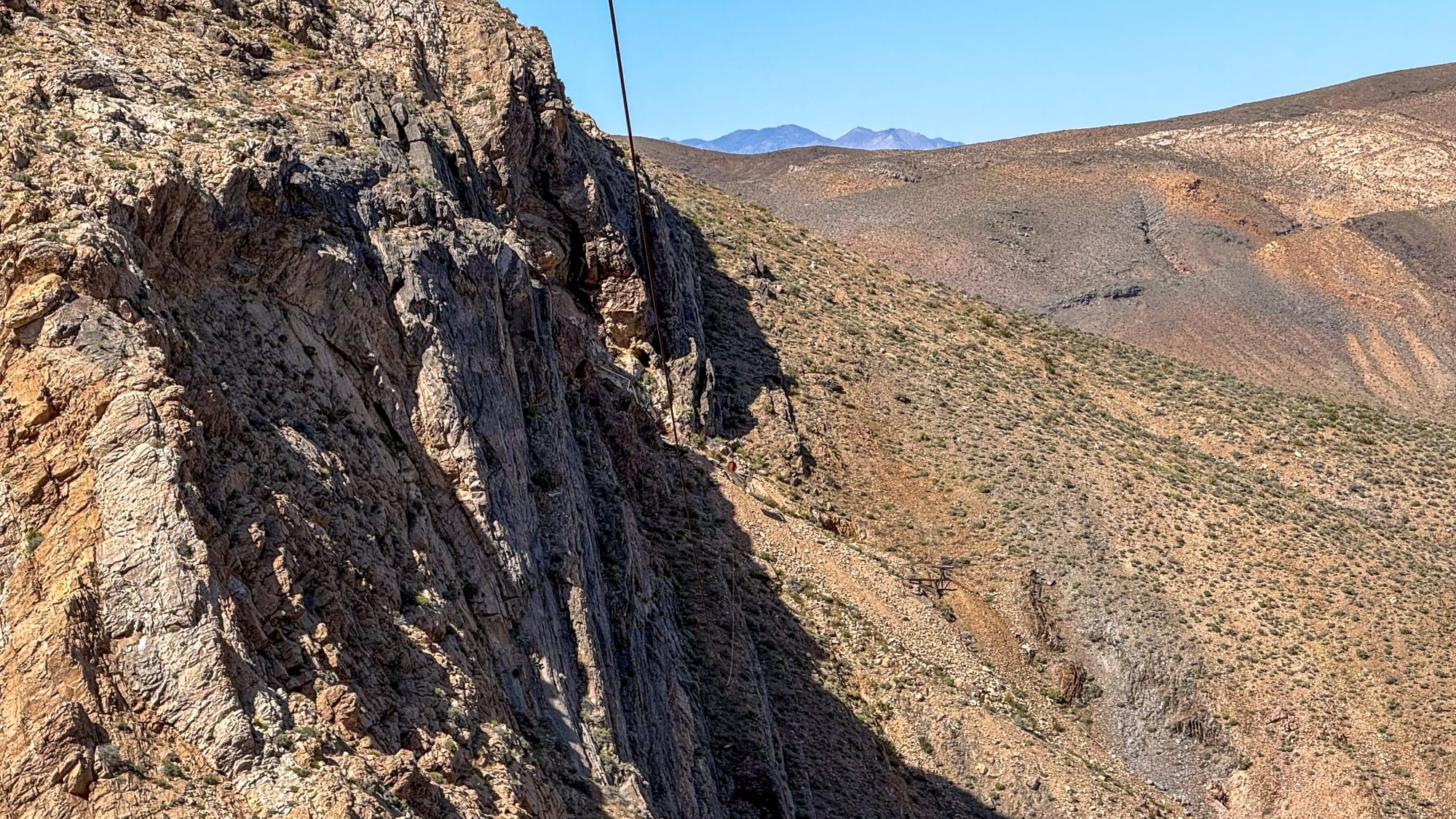
What makes this cableway unusual is its geometry. This is not a tramway that drops ore down a steep slope to a mill below. The mine is actually lower than the millsite-end tower, and the canyon between them is vertical-walled. The cable spans horizontally across that void, with the mine entrance on the far wall at a lower elevation than the terminus on the mill side. Ore coming out of the adit would have been loaded into buckets and hauled laterally across the canyon and slightly upward to the receiving end on the plateau. That is a meaningful engineering distinction. The problem the builders were solving was not elevation, it was an impassable canyon wall with no other crossing. The tag line pulleys are still attached to the H-frame and the mount for the winch is still there too.
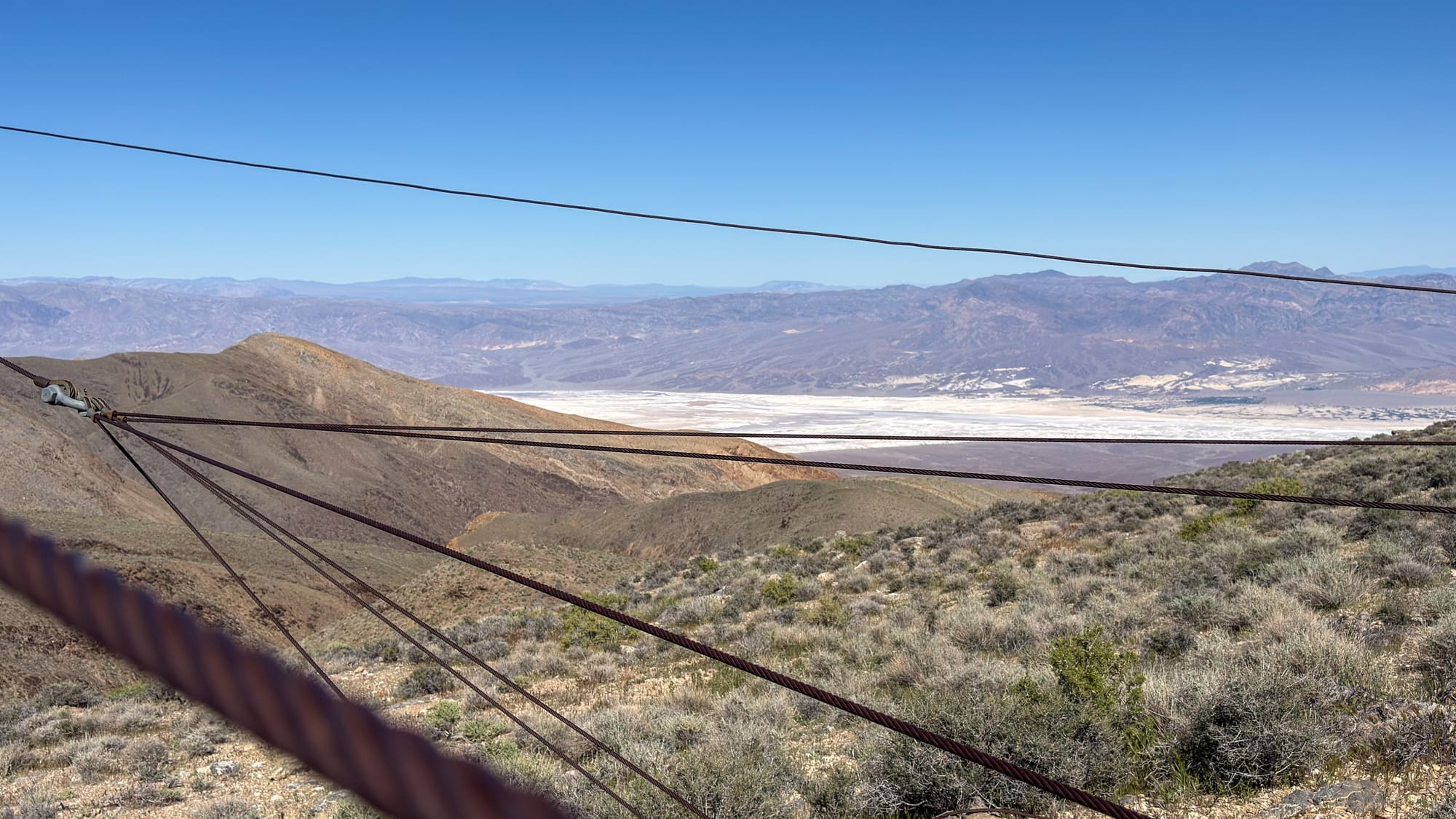
Looking out from the tower, the view frames everything that made Skidoo worth the effort. The valley floor is thousands of feet below, the salt flats bright white in the middle distance, the Funeral Mountains layered in blue beyond.
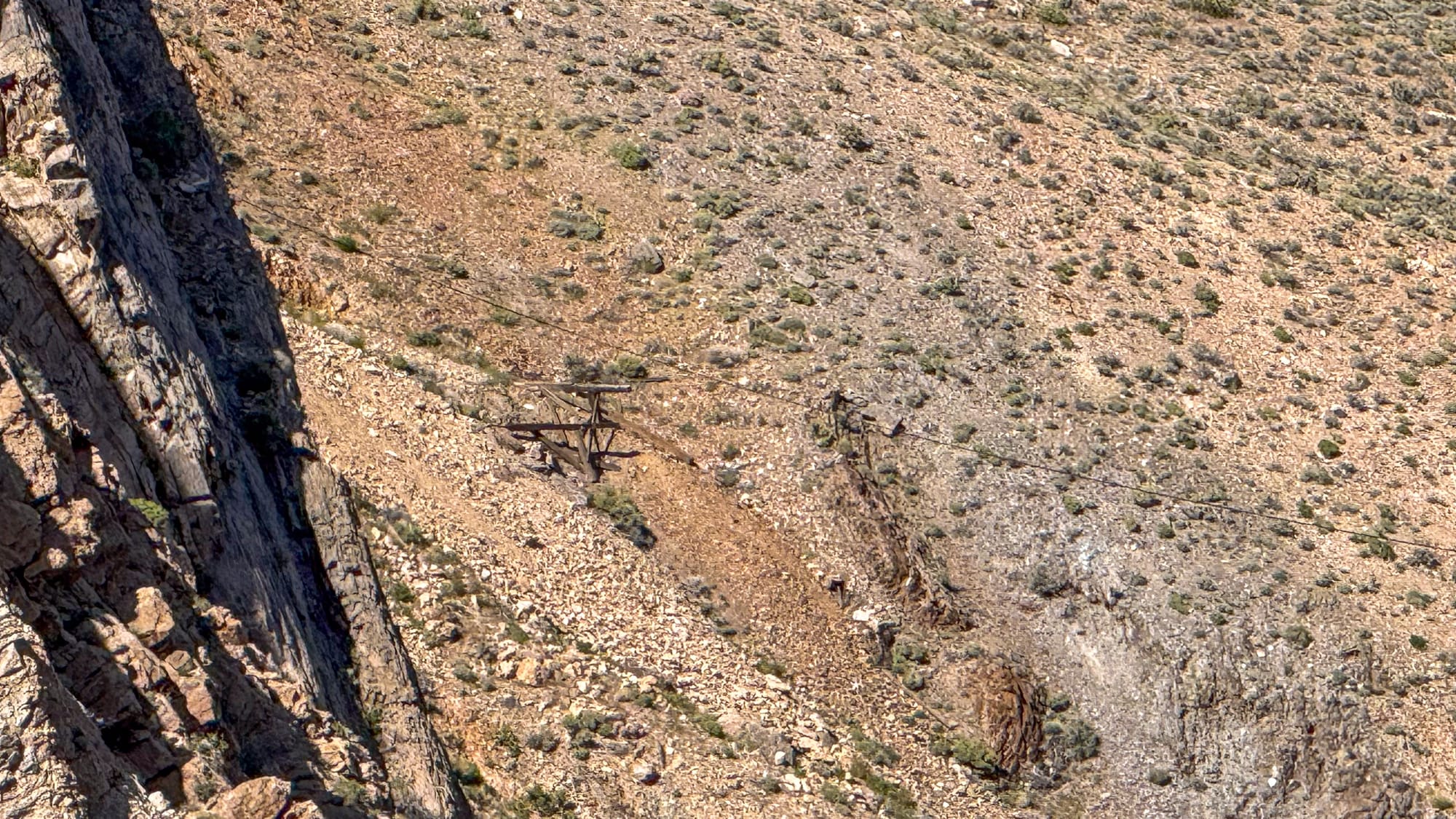
On the far side of the canyon, visible from the tower, the remains of a mid-span timber support structure have collapsed onto the talus below the cliff. The adits in the cliff face are clearly visible across the gap, dark openings in the banded rock, with small dump aprons below them. Getting to the mine itself from the mill side would require descending into the canyon and climbing the far wall, which is not a casual undertaking.
The Hanging Cliff Millsite was at the end of the cableway I was at. The mine is across a vertical walled canyon and I'll need to come back and explore to figure out how to get to it. I'm not going to be riding that cable!
The Later Camp
Before you reach the cableway you pass through the later camp, likely the "Hidden Wash, McFarlin and Durham Mining" camp referenced in the NPS Survey and it tells a different story from the original boom-era operation.
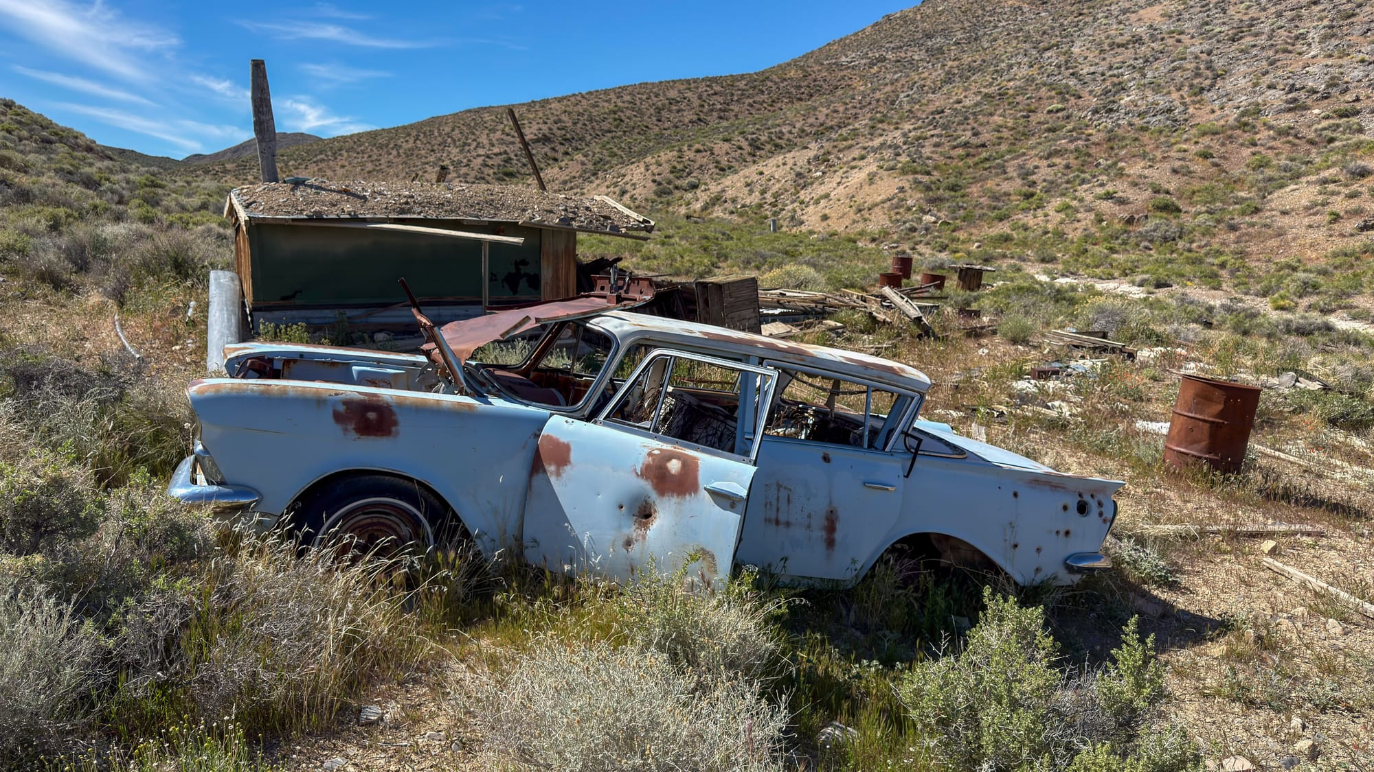
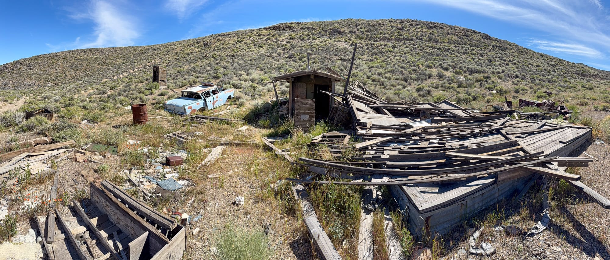
The most immediately visible feature is a late 1950s American sedan, pale blue, sitting in front of a collapsed structure with its doors hanging open and rust blooming through the original paint. That car is a reliable date anchor. It places the camp's active period squarely in the mid-century revival era, when small operators and leasers returned to the Skidoo district after the 1934 Gold Act removed the price restrictions that had kept gold at $20 per ounce for decades.
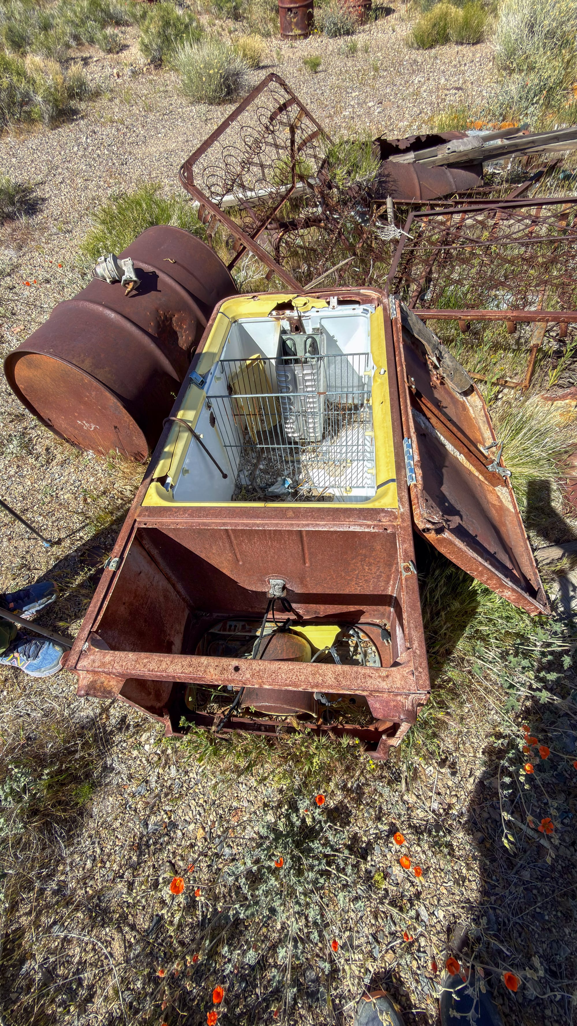
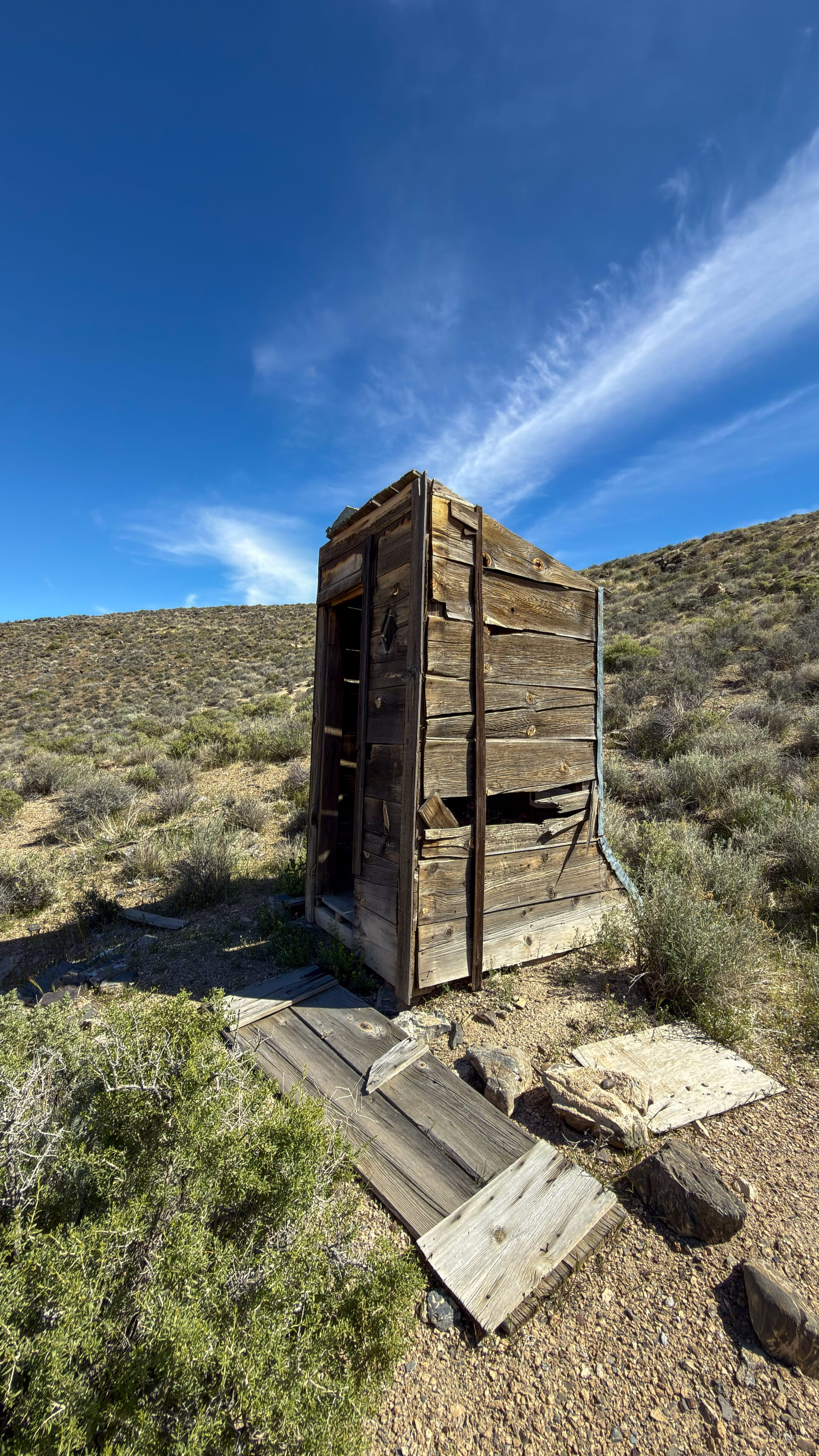
The rest of the camp inventory matches. A yellow-enamel chest freezer, lies open among scattered oil drums and wire. A substantial outhouse still stands in good condition relative to everything around it, heavy timber construction, door on the ground, floor platform partially displaced, and birds living in the bowl. Two wooden structures have collapsed completely, their dimensional lumber splayed out across the ground in flat pancakes with sagebrush growing through the gaps. A rusted battery box or electrical junction housing sits in the brush with tramway cable coiled beside it.
The mid-century operators were working a different calculation than the original rush-era miners. They had better chemistry for processing tailings, access to vehicles instead of mule teams, and the benefit of knowing exactly where the original workings were. What they were after was material the earlier operation had left behind, low-grade waste and partially processed dumps that were now economic at higher gold prices. The neighboring Blue Bell and Garibaldi Mine complex, documented in the same NPS survey that recorded the Hanging Cliff, saw exactly this pattern. A lessee shipped roughly 150 tons of selected material from that adjacent property in 1967. Whether the Hanging Cliff camp produced anything significant in this period is not recorded in the sources available.
The camp sits in a canyon wash with the cliff face rising on one side, a contained and sheltered spot. California poppies were coming up through the gravel on the day we visited, orange against the rust.
The road to the camp. Then the
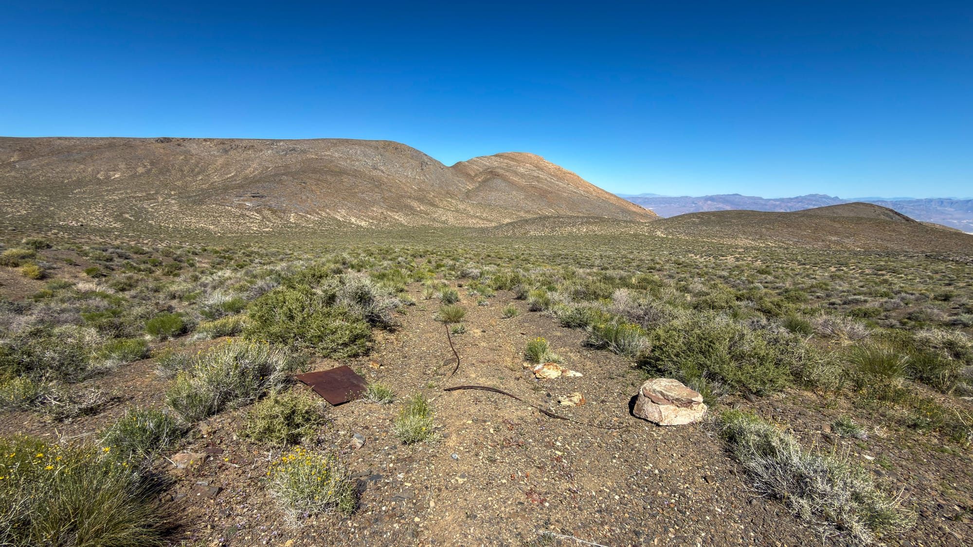
The IGRB Plaque
Finding the bronze plaque placed by the University of Florence research team is a small surprise. The Italians in the Gold Rush and Beyond Project documented Italian immigrant contributions to western mining history, and this site rated a landmark designation. The plaque credits researchers Sara Bindi and Laura Polverini alongside Prof. Trojani, and lists the site formally as the Skydoo-Garibaldi Mine. It connects a property that most visitors to Death Valley have never heard of to a thread of immigrant labor history that shaped the entire district, the Italian miners who were working these canyon walls in the 1870s, decades before Ramsey and Thompson ever rode up Emigrant Canyon in that famous fog.
Getting There
The turnoff for the Hanging Cliff Mine comes before the Skidoo townsite, heading east off the main Skidoo road toward the canyon rim rather than continuing west to the mill. The wilderness boundary is foot and horse traffic only past the road end. The walk crosses open plateau before the terrain begins to break toward the canyon edge. Plan for a few hours if you want to spend real time at both the camp and the cableway.
The site is entirely within Death Valley National Park. All historic structures, artifacts, and mine workings are federally protected. Do not enter mine workings.