How Badwater Got Its Name
A Parenthetical in the Desert
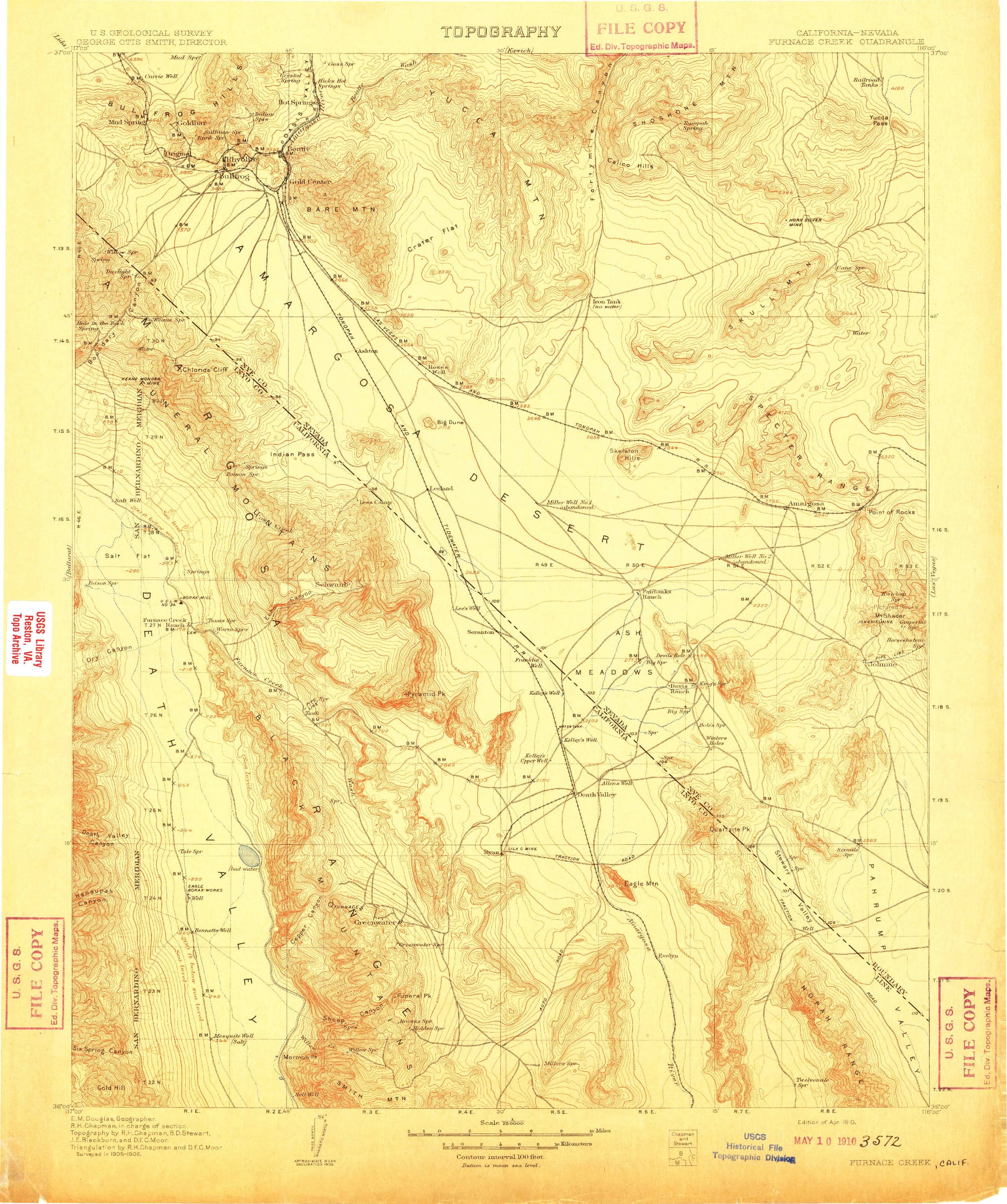
Most famous place names come from drama. An explorer plants a flag, a pioneer survives something harrowing, a prospector strikes it rich. Badwater got its name from a surveyor who couldn't get his mule to drink.
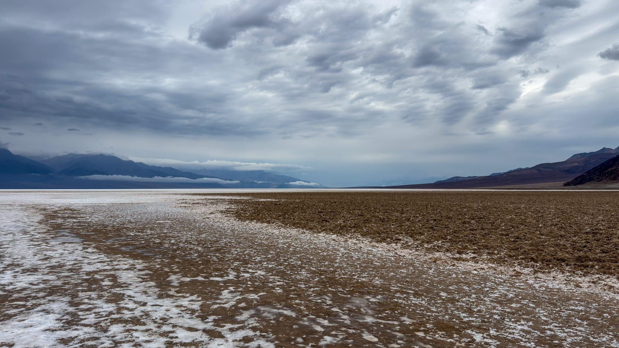
When USGS surveyors were mapping Death Valley in the late 19th century, they annotated their field maps with brief functional notes about what they found. A spring that tasted of salt and mineral got a two-word descriptor in parentheses: (bad water). It was the cartographic equivalent of a sticky note. Don't drink this. Move on.
That notation made it onto the printed topo map, sitting in the same typeface as the elevation benchmarks, the borax works, and Bennetts Well nearby. No drama, no dedicated label, just a small cautionary aside tucked next to a pool that nobody would want anyway.
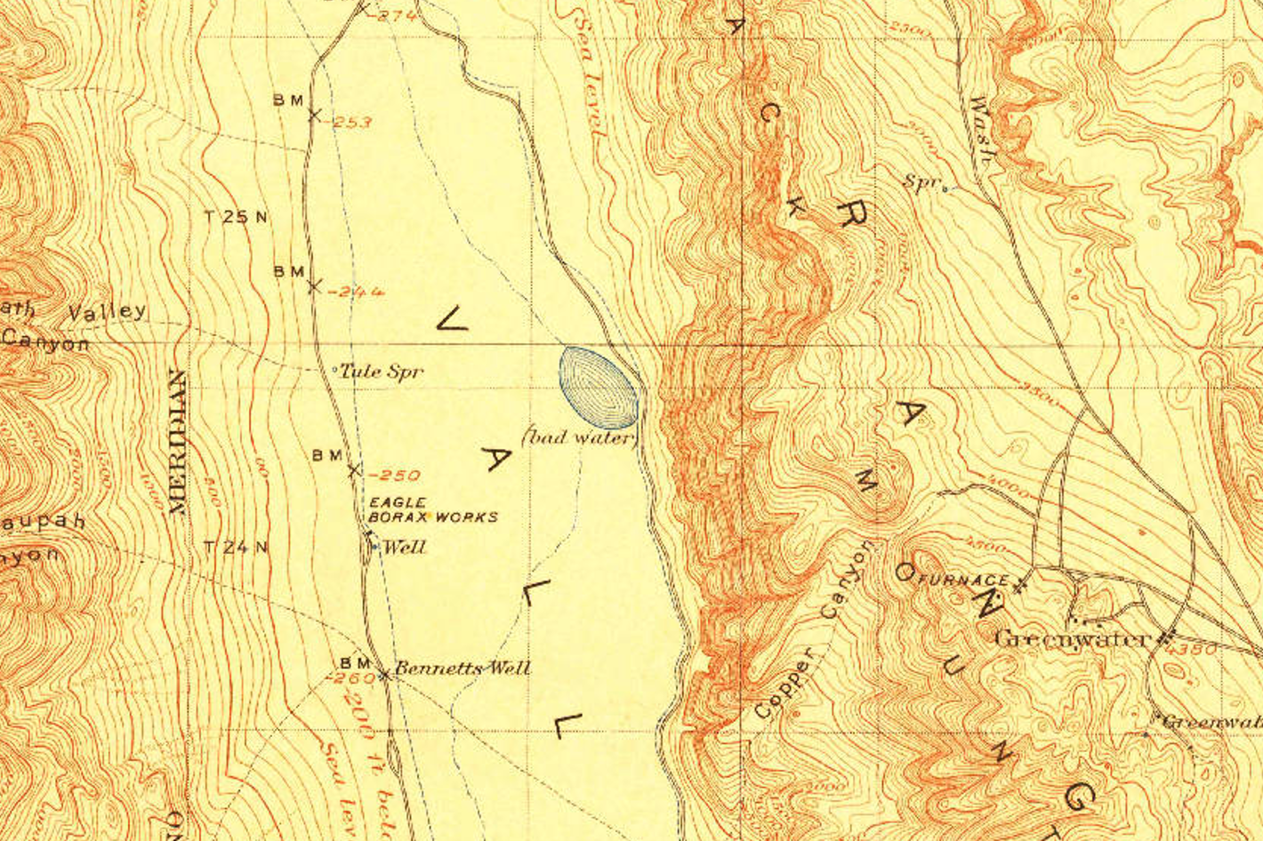
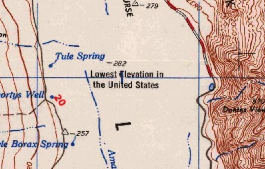
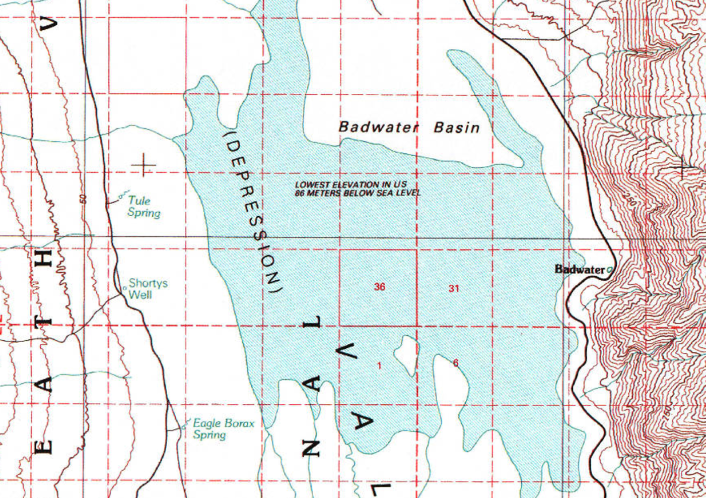
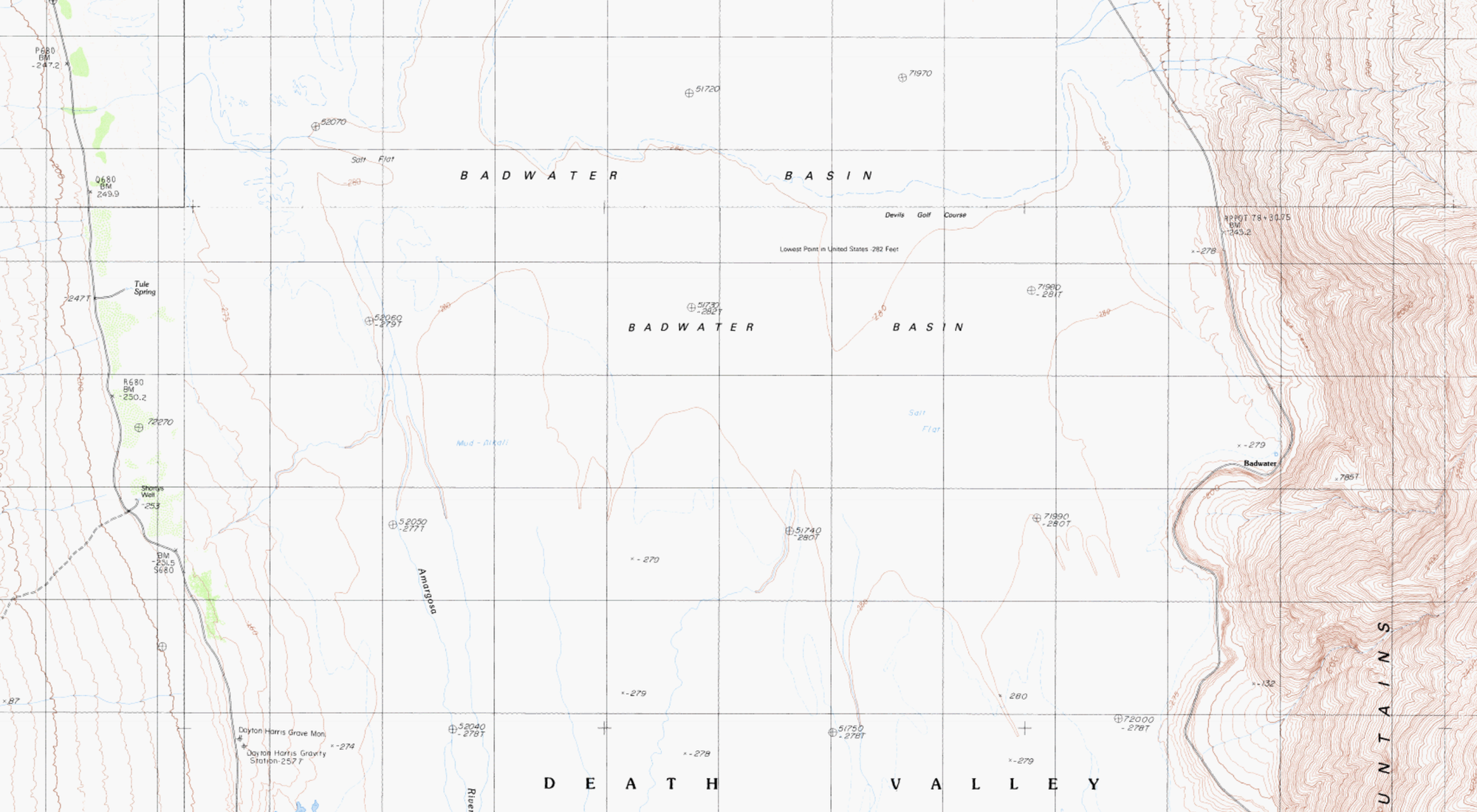
Over time the parentheses disappeared, the space closed up, and the descriptor became a proper noun. "Bad water" became Badwater, a named spring, then a named road, then a named basin. The lowest point in North America, 282 feet below sea level, carries a name that started as a surveyor's shorthand for undrinkable.
The water itself isn't poisonous. It's just very salty, fed by an ancient aquifer that dissolves minerals from old deposits on its way to the surface. Pickleweed grows at the edges. An endemic snail, found nowhere else on earth, lives in the pool year-round. The place is more alive than the name suggests.
Worth noting for anyone who makes the trip: the parking lot and the pool are not the lowest point. The basin floor slopes gradually away from the road, and the true low point is about 3.4 miles out at a bearing of 285 degrees magnetic (273 true). Most visitors never get there. They take a photo at the sign, walk a few hundred feet onto the salt, and head back to the car, which is fine. The basin earns its reputation long before you reach the bottom of it.
But the name stuck, the way field notes have a habit of doing when they make it onto a federal map. Maps become reality. A parenthetical becomes a landmark.
References
- National Park Service, "Badwater Basin," Death Valley National Park. https://home.nps.gov/places/badwater-basin.htm
- Historical Marker Database, "Badwater Pool" (NPS interpretive sign, Death Valley National Park). https://www.hmdb.org/m.asp?m=159465
- USGS TopoView, Death Valley quadrangle series (historical scans). https://ngmdb.usgs.gov/topoview/
Full Maps